I have the “HowGOESit” desktop widget for OS X. GOES stands for Geostationary Operational Environmental Satellites.
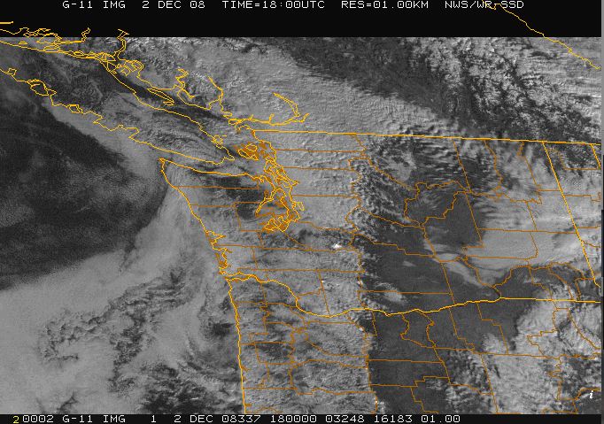
They just hang out up there, sending data down here. You can grab their output off the Internet – usually mere minutes after it is taken. Is that cool or what? We really do live in amazing times. I often look at the latest GOES image for where ever I happen to be, which 99% of the time is here in Washington. Not long after I posted about “December in Seattle” the weather decided to prove me wrong by going spectacularly clear. The above image was taken the DAY OF my timelapse movie… you can see western Washington blanketed by low clouds. The Cascade volcanoes stand a bit above, or in the case of Mt. Rainier, WAY above the clouds. (See Paul, the sun always is shining here… it just doesn’t make it all the way to the ground!) The Cascade Crest in Oregon is clearly delineated by the clouds as well. Very cool.
Then two days later, we get this:
![]()
Oh well, the weather can prove me wrong, but it just can’t shut me up. 😉