So I’m alone, in Albuquerque, with a nice car and no co-driver. Our plans have gone awry, and I have a few choices of what to do next. One is to just continue on to SoCal and visit friends. I’ve already seen the Grand Canyon, so no need for that side trip. Another option is to drive straight home by the most direct route. It’s between 1200 & 1400 miles, depending upon which “direct” route I choose. But here is where I have to admit a personal quirk: I like to drive on roads I’ve never driven on. I’ve been wandering all over this continent in a car since I was a kid, and it never ceases to amaze me at the wonders one can find by taking a road you’ve never been on before.
Back in 1999 when my dad and I ran the Cannonball Classic we were issued a Rand-McNally Road Atlas with our route highlighted across it on every relevant page. After the rally I kept that atlas (I still have it, though it is dog-eared and torn up) and sat down and from memory highlighted every highway I’d driven on as far back as I could recall. Since then it has been replaced a few times, and I’ve kept highlighting roads as I drive them. yeah, it’s a quirk, but it’s my quirk. For example, here is my highlighted atlas pages for northern California’s highways I have driven:
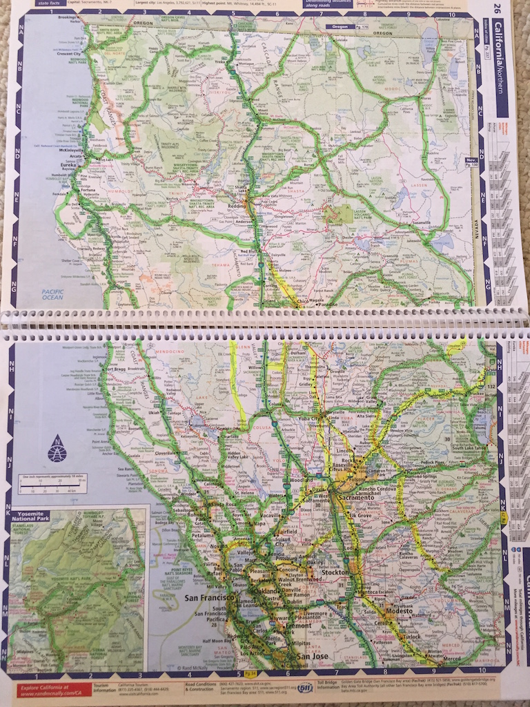
If I have the time, I like to find those Unhighlighted highways, and then go drive them. As you can see, I’ve covered a LOT of NorCal. There’s only about 10 state highways I’ve yet to see in that area. Sure, I’ve driven I-5 a zillion times, but when I can, I try to get off that superslab and wander.
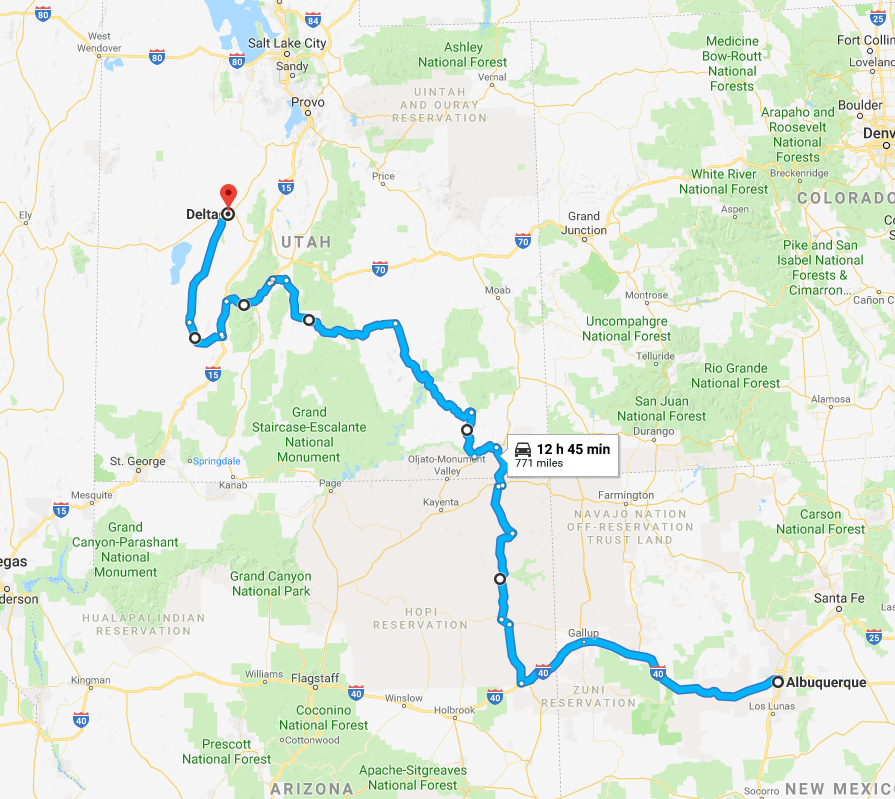
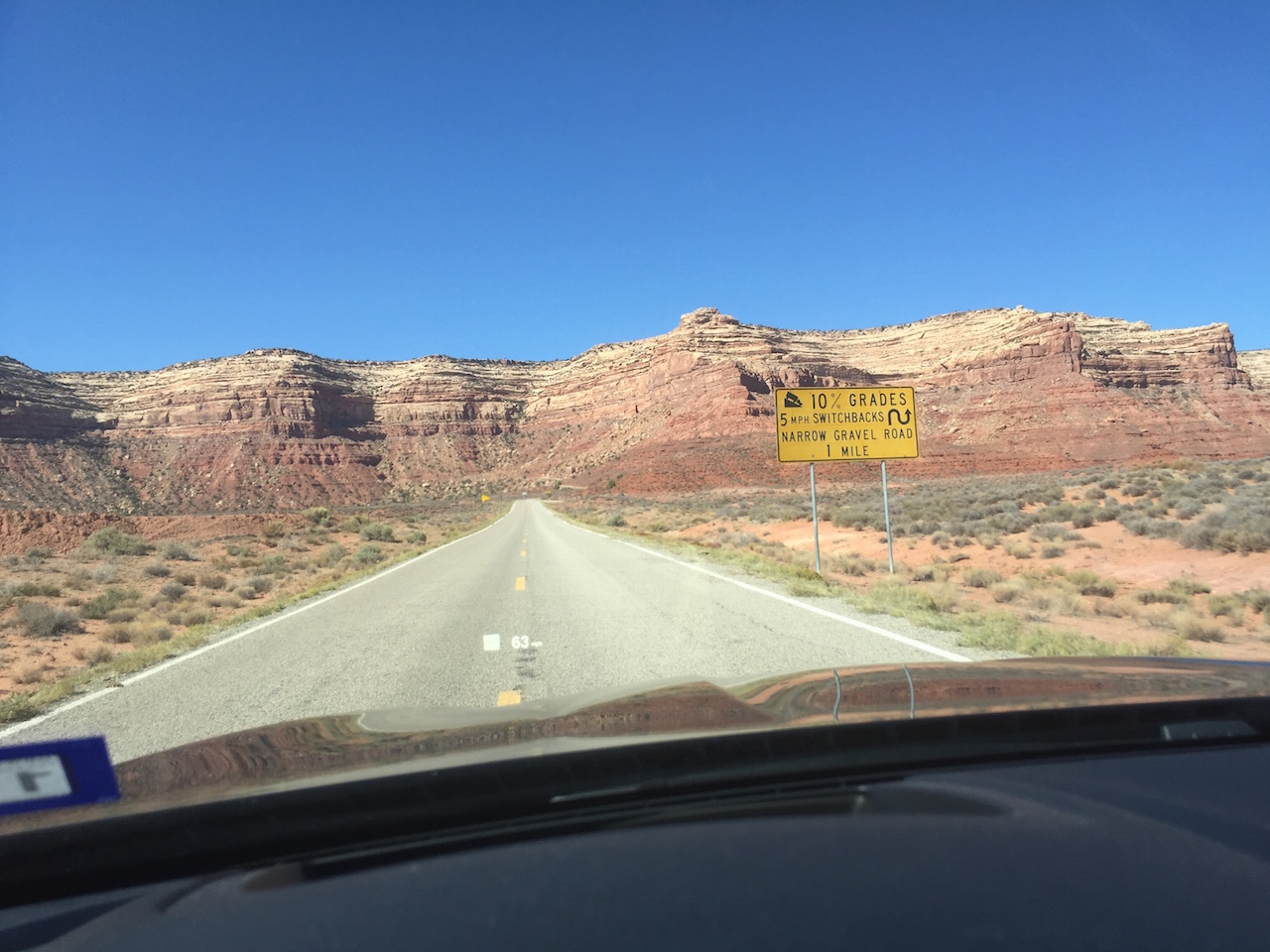
Out of habit, I had packed my atlas with me, so in my hotel room in ABQ after dinner with Ben I perused possible routes. I had never driven the strech of I-40 between ABQ and Flagstaff, AZ. I had never driven the stretch of US 191 along the eastern side of Arizona either. There are still many roads of Utah that remain unexplored. Nevada has been entirely criss-crossed (and all within the past twenty years) as it is one of my favorite places to drive. I mean REALLY drive. However there’s still a couple of highways in the far NE corner of the state that I have yet to see. Idaho & Oregon (and Washington) are almost completely covered in highlighter but I see one empty section that links up with my unexperienced part of Nevada. I mentally connect all the roads and make my plan. I know this can be done in two days, especially since I have done similar drives in an open 50+ year old Jaguar, so cruising in a modern luxury sports sedan should be a breeze, right?
I’m not a huge fan of Interstates, but I-40 has some history. It largely overlays the old Route 66 along this portion. It is cold and snowing intermittently. Not enough to accumulate, but enough to keep me rolling below the speed limit. I had a good night’s sleep and am feeling ready for the day, but I wasn’t expecting this weather. Thankfully it clears as I drop out of the mountains. Once I’m into the desert on US 191 the sky is clear, and blue, contrasting with the greens and reds of the landscape.
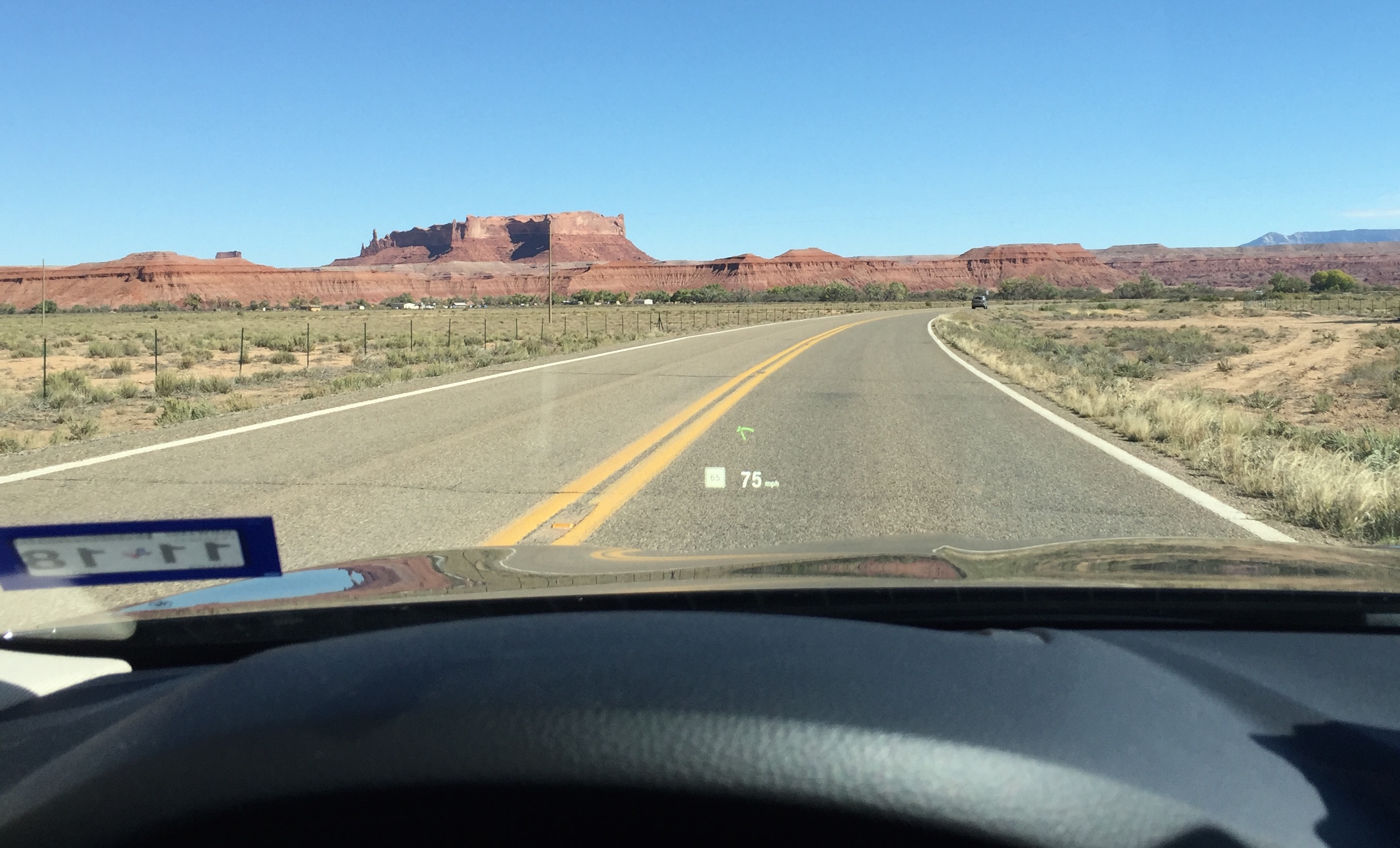
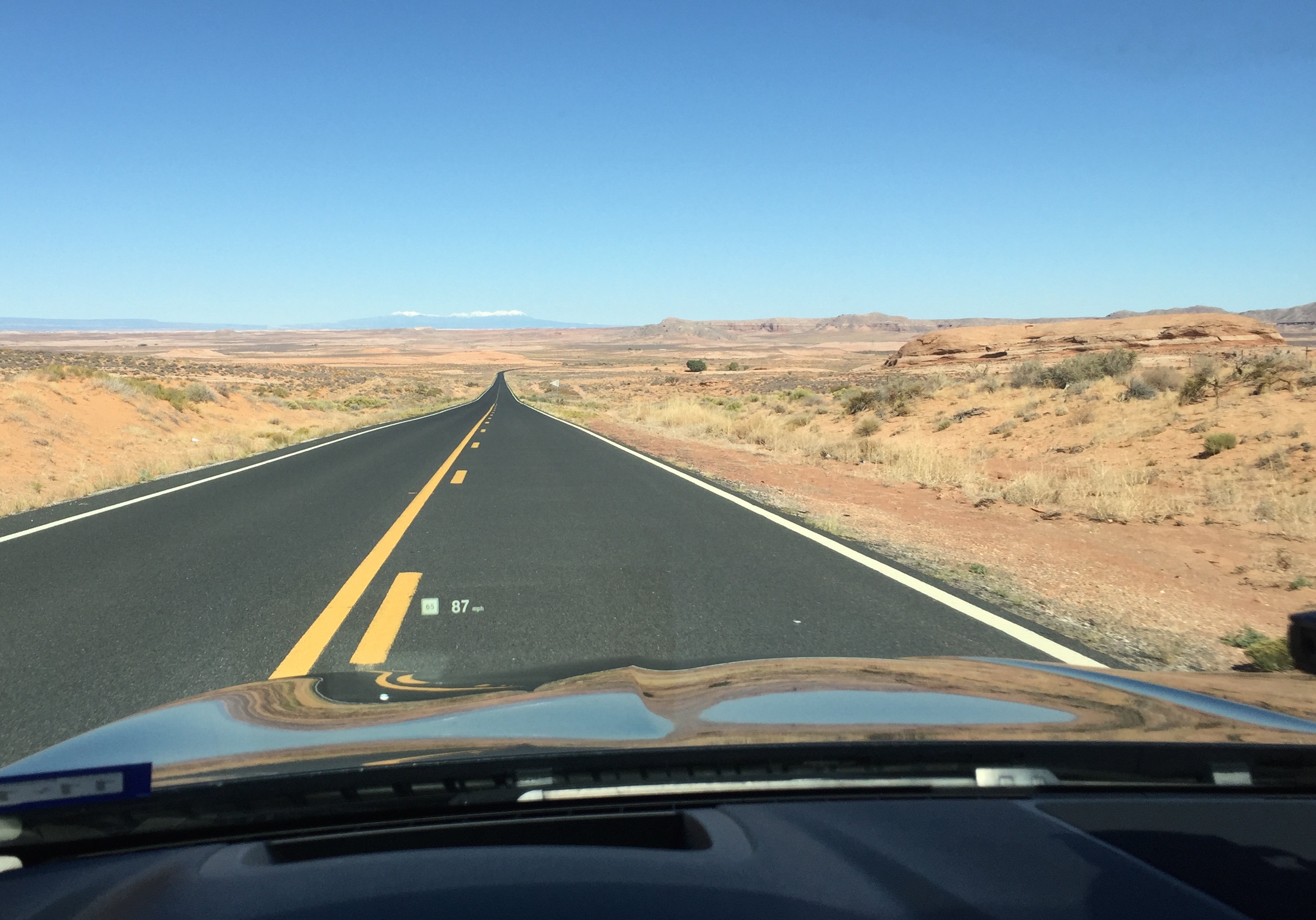
I’m traversing the area near Canyon de Chelly, and while I can glance right and see into the opening of the valley at the mouth of the canyon, I really don’t have the time to explore. No Spider Rock this trip. The good news however is that with the clear weather I can pick up the pace a bit. The car feels good, though heavy. The twin-scroll turbo provides pretty smooth power delivery with minimal lag, but the ever-present kick in the butt when you really put your foot in it. What really astounds me is the sheer amount of technology. Lane departure warnings, blind spot warnings, etc. I turn all of them off because they are a distraction. I don’t want my steering wheel to vibrate when I follow a good line through a corner because some sensor sees a stripe. The ZF 8 speed transmission is probably the nicest, smoothest, most responsive automatic I’ve driven. Yeah, I’d prefer a third pedal, but this will do.
I stop for gas in a town called “Mexican Water” just before heading into Utah. I’ve dropped from 32 MPG to 27 MPG, mostly due to the elevated pace. But 27 MPG is pretty good for a big sedan. Thats about what I get in my tiny sports car, which weighs likely a third less than this car (but has a bigger, naturally aspirated engine, and a third pedal.) So far, so good.
As I pop up into Utah the bank of white I’ve been glancing at on the horizon, which I felt are mountains but could be clouds, resolved themselves into a clear, snow-covered mountain range. Based on the map I figure it is the La Sal mountains, which are the second highest range in Utah. they’re visible from all over the canyon lands and consistently present a snowy contrast to the red, yellow, and white sandstones of the whole SE quadrant of Utah. I’ve seen them from every angle in my long travels dating back to the early 80s.
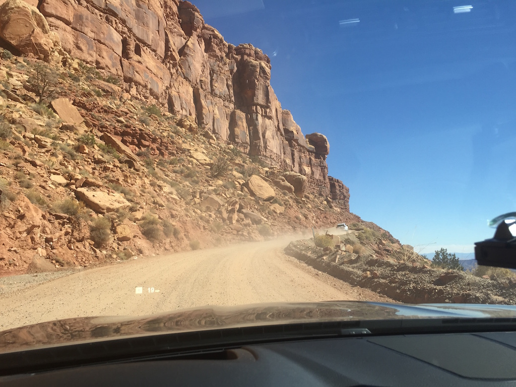
I’ve driven most of the roads in this corner, most recently on the 2011 Southwest Oil Leak tour. On that tour we took a right turn to Blanding, Utah and this time I’m turning left towards Capitol Reef and central Utah. But first I do a repeat of ascending Moki Dugway! What an amazing bit of road. You would never know it as you approach this wall of rock, but a there is a road going right up it:
It’s a fun drive. Steep. Switchbacks. Gravel. NO GUARDRAILS. Dizzying drop off the side. Not for the faint of heart, but I drove it in an E-type, so this car should be a breeze right?
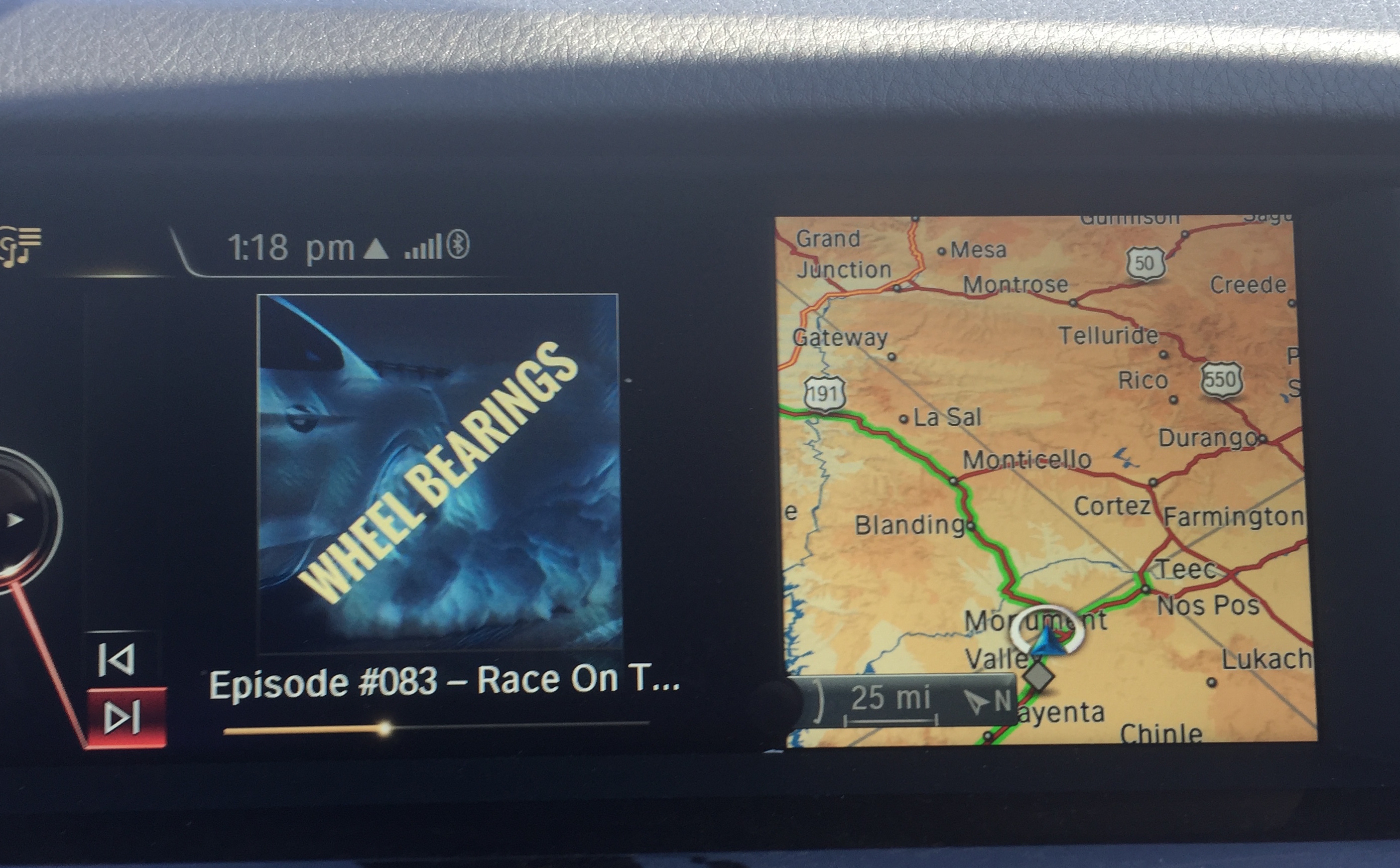
Yeah. I don’t even stop. But speaking of E-types, I was listening to a podcast via the bluetooth audio integration. It is “Wheel Bearings” and Sam & Dan read an email from me about the E-type. Oh the irony!
Utah Highway 95, that left turn just past Moki Dugway, is open, empty and a lot of fun to drive. Beautiful vistas of green trees and red rocks, and the extreme end of Lake Powell where the Colorado and Dirty Devil rivers converge. The road then follows the Dirty Devil as it comes down from the northwest. It is an amazing landscape that so engages me that I forget to ever even try to grab any photos. About the only traffic I pass are a few two-wheeled touring types, both motorized and pedal-powered. No trucks. Very few cars. Some of the most enjoyable ninety miles I’ve ever driven.
At Hanksville the route turns left again on Utah Highway 24 through Capitol Reef and then into the agricultural mountain valleys of central Utah where the red rocks turn into green valleys and snow covered mountains. There is some actual traffic here, park visitors and locals going to and fro, so progress is retarded a bit until I pick up I-70 in Richfield. The superslab takes me down to the confluence with I-15 where I head south to Beaver, Utah where I find some non-ethanol gasoline at a Flying J. Here I’m at the edge of the Basin & Range part of the West. The wind is blowing hard out of the north and is VERY cold. The sun is also sinking towards the horizon. using an app on my phone I book a room in a hotel in Delta, Utah directly north. yeah, I’ve done a weird S-curve through central Utah but that is dictated by topography and a larger degree to my choice. I want to knock off another new road: Utah Highway 257. It is a road that parallels I-15, but one range and basin west of it. I’ve driven the two east-west roads here (Utah 21 and US 50, aka “The loneliest road“.) I saw this as an opportunity to check off this very remote road.
It is indeed remote. But it provides a spectacular sunset and a wide valley with nothing but a railroad and some wind farms. I see maybe three other vehicles for sixty-six miles. It is pitch dark when I arrive in Delta, grab a dinner at a Mexican place, and then check into my hotel and instantly fall asleep.